Up and at ‘em. Packed
& stowed and on our way again. On leaving
the park, while we were doing the “Dump” we noticed that there was a fish
cleaning station complete with cutting boards, suspended hoses and an insinkerator
for the guts (they know how to set things up over here). A great idea to keep the area clean.
30 minutes on the
road and we decided to listen to some music.
Plugged in Steve’s ipod and thus began 310 miles of Steve’s WTF music (everything
from Boney M to Dixie Chicks to Kenny Rogers to Roxette to U2…. I think you get
the idea LOL). Ros kindly called it the “eclectic
mix”.
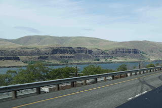
The scenery changed a lot on this leg of the journey, but
for the most of it, it was pretty stark.
To start with there were lots of wind turbines on both sides of the
Columbia River (Washington to the North & Oregon to the South). The highway (I 84) was in really good nick so
travelling was comfortable. There was a
lot of farmland consisting of grasses, grains and trees. We saw a sign warning of “Blowing Dust 20
Miles”. Generally didn’t see much but we
did encounter a bit here and there.
After going through Pendleton we encountered a long mountain
pass climb & stopped near the top at a view point for a quick break, leg
stretch & toilet stop. We got to the
summit of the blue Mountains pass a little later, altitude 4193 feet. We also crossed over the 45th parallel
(halfway between the equator and the North Pole). Back into farmlands and miles of plains in
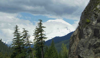
the distance. We also had snow-capped
mountains in the distance for a while as well, quite scenic. We passed a truck towing 2 other trucks that
were kind of piggy-backed on top of each other.
We were following beside train tracks for quite a while and
at one point we saw two tunnels going into the side of a hill and only one at
the other side. We figured they’d found
something a bit hard or soft on their way through for the unfinished tunnel.
On crossing the border from Oregon into Idaho at Ontario we
found the speed limit on the I 84 go from 65 to 75 Miles/hr (120K/hr). Again the scenery from here to Boise (pronounced
boy-see) was mainly flat and barren with some farming here and there along the
way.
We arrived in Boise (or Meridian, an outer satellite town of
Boise) at around 5:30. We also had to wind our clocks forward an hour to get on
to “Mountain Time” (so had arrived at around 4:30 our normal time…. Hope we’re
making sense here J). As we were driving into Meridian a bloke in a
pickup truck passed us by with a large sticker on the back windscreen that just
said “TOOL” …”hhmmm right there sunshine”.
We were following “Lucy” (our pet name for the Garmin or sat
nav) to a camp ground but due to some one way street creations and the fact
that the grounds were off the road a little and not easily seen, we ended up
doing couple of blocks a couple of times over, but we got there in the end.
Walked up the road to get a few more groceries (and some
exercise after sitting all day), cooked a nice steak and now kicking back with lovely
white wine with a splash of peach juice in it…. Ah…… this is the life.
Click the link below to see where I am located.
If the above link
does not work, try this link:


